© Survey Department, Jamaica
Back to Home Page
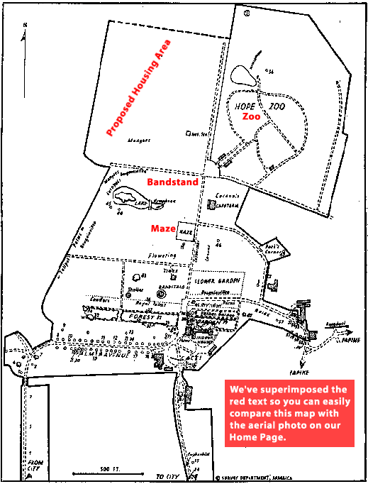
[Below] is a blow-up of the
map of "The Royal Botanical Gardens, Hope" in Alan Eyre's "The
Botanical Gardens of Jamaica". Definition is bad [but] the map
clearly shows the site.... It is clearly part of Hope Gardens and was then used
as the site for the mangers for livestock and the Hope Gardens Meteorological
Station.
Since this station was in operation in the 19th century under the same name,
I believe that this puts beyond question the ownership and use of the land.
It is also clear that the area of the property is understated because of the
double dotted line at the top, indicating that a part has been cut off, obviously,
for the purposes of this reproduction.
-John Maxwell
Surveyor's Map of Hope Botanical Estate
in St. Andrew. (1966)
© Survey
Department, Jamaica
Back to Home Page